
|
DEDICATION
These notes are dedicated to the memory of Joan Abrams (1927-2009), a founder member of the Dinghy Cruising Association (DCA) and for many years editor of the DCA Bulletin. Joan grew up in Heswall on the Wirral shore of the Dee estuary and spent her formative years sailing here with her father before the Second World War. She loved the Dee estuary and attended DCA rallies here almost until she was 80. Her own explorations of the Irish Sea by small boat ranged west around Anglesey and Lleyn, north to the Solway Firth, and across the sea to Ireland, and the written descriptions of her voyages greatly inspired my own sailing. |
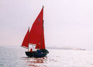
Joan Abrams in Falmouth Bass Boat 'Pladdy Lug' bound for Hilbre in the Dee estuary
|
It was her own notes on the Dee estuary [DCA Bulletins 12, autumn 1961, pp11-15, and 77, winter 1977, pp17-20] that inspired me to write an updated version [DCA Bulletin 203, summer 2009, pp25-28] which is now revised here. Joan was something of a sailing purist and was reluctant to use an engine, so these notes are written in the spirit of the kind of sailing that she loved best: in a small open boat under sail and oar.
Abbreviations
|
N S E W directions
SC sailing club DCA Dinghy Cruising Association |
HWS high water spring
LWN low water neap HW-3h three hours before high water LW+2h two hours after low water |
NM nautical miles
ca cables (1 ca = 200 yards) m metres ft feet |
Overview
|
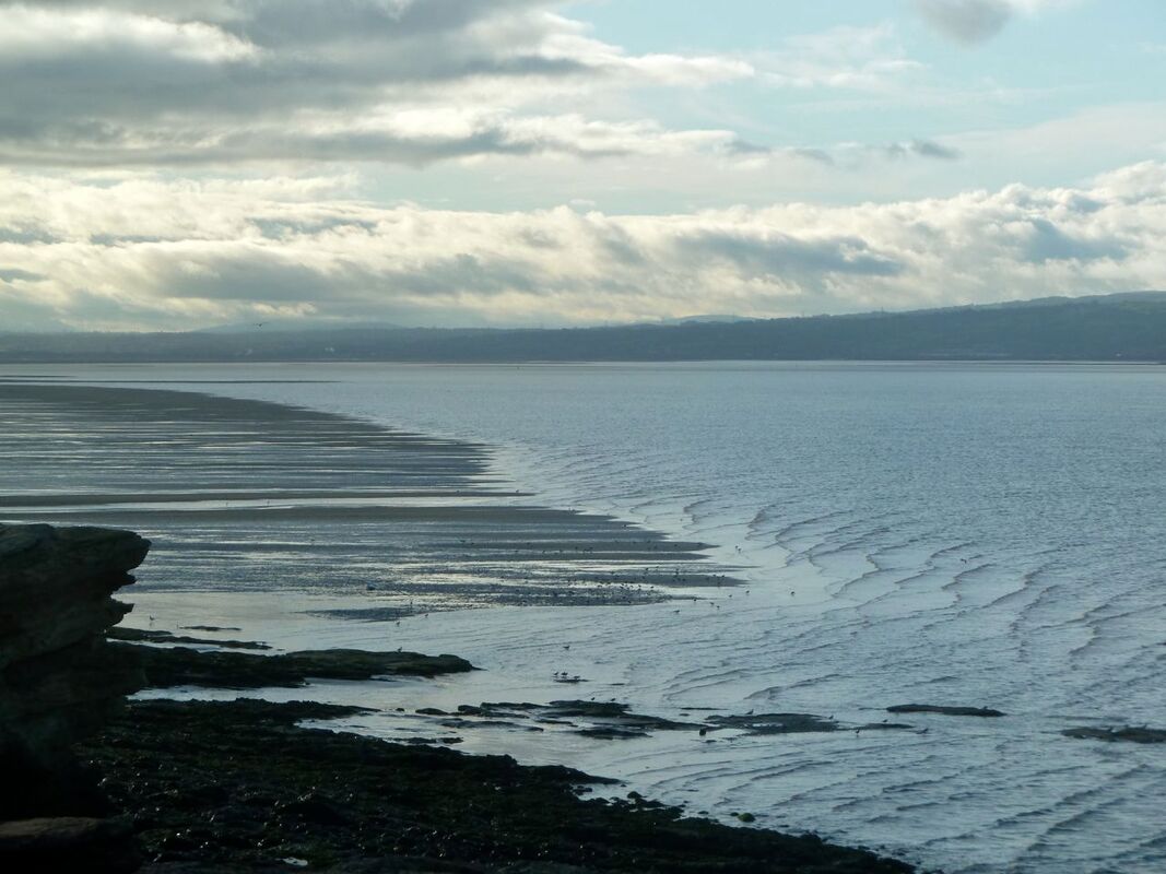
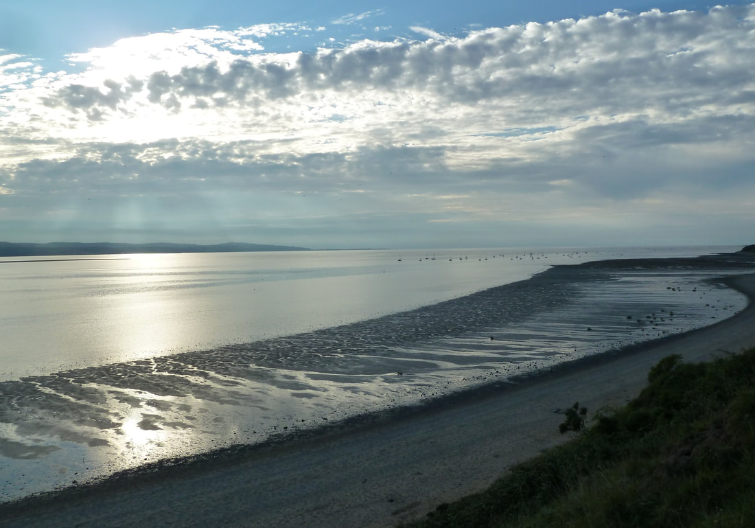
Liverpool Bay lies in the eastern corner of the Irish Sea where Wales meets Lancashire. Into the Bay disgorge two significant river estuaries: the Mersey, which gives access to the port of Liverpool, and the Dee, which once gave access to the now land-locked ancient Roman city of Chester. Between the two estuaries lies the Wirral peninsula. The area is dominated by enormous tides, which can range in height by as much as 10 m (33 ft) at the mouth of the Mersey and can generate modest tidal bores in the narrow reaches of the upper estuaries. When the tides ebb they expose huge areas of flat sand & mud. This poses a challenge to the small boat sailor in that, throughout the whole region, launching & recovery by trailer is restricted to within about two hours either side of high water (HW+/-2h) (unless you can find a tractor to tow you across the beach,) and furthermore, once out on the water, access to sheltered anchorages is limited to the same extent. Once you are out at sea between tides, therefore, you are committed, and little shelter can be had before the next HW. So these are exposed coasts and careful consideration must be given to the weather, especially if the wind is likely to be onshore.
|
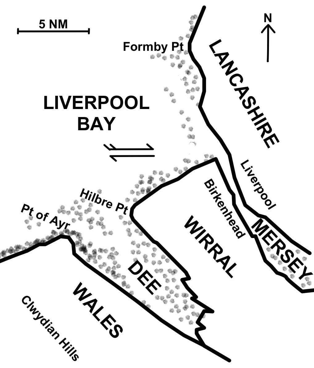
Liverpool Bay, where Lancashire meets Wales
|
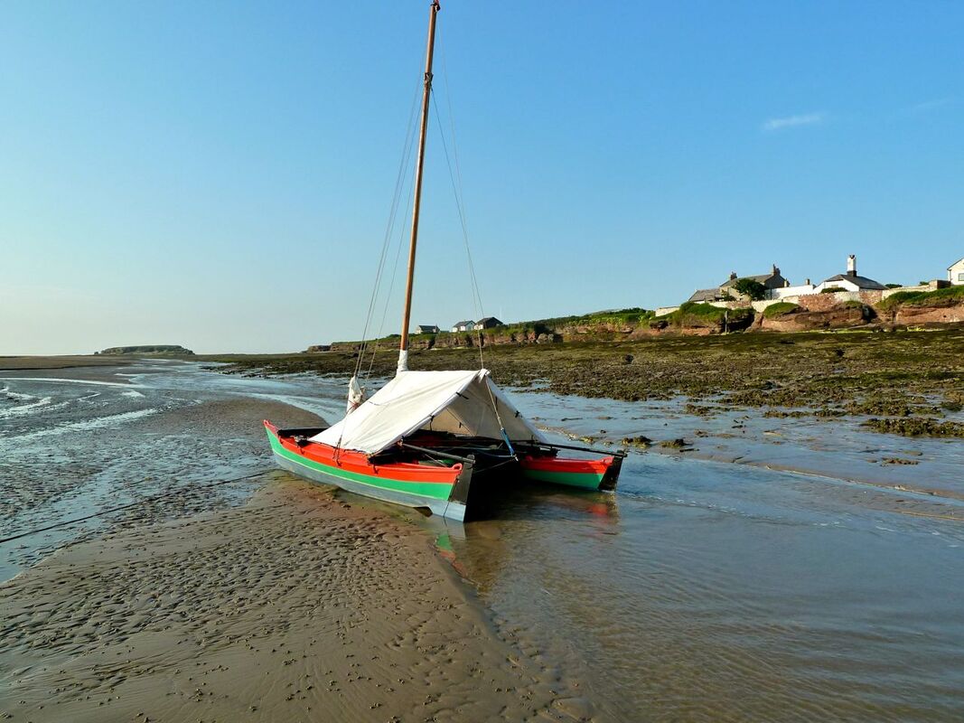
In fine weather, however, this is an immensely rewarding and exhilarating area to explore under sail. I hope these notes will encourage some to make the exploration and make the experience worthwhile. They are written from the point of view of sailing a small boat of about 1 ft draught (plate up), from which depth can be sounded with pole or oar, and assume that skipper or crew is able if necessary to hop overboard to drag the boat off after inadvertently grounding.
Tidal Streams
In Liverpool Bay the flood stream runs eastwards up the coast of N Wales towards the mouth the of Mersey on average for about 5 3/4 h, and the ebb stream runs westward down the coast for about 6 3/4 h, with maximum rate (at springs) of about 1.5 kt. The rates however are significantly accelerated in channels between sandbanks and within the estuaries.
The tide runs particularly strongly in the narrows at the mouth of the Mersey and in the shipping channel where the stream is constrained by training walls, here it is often impossible to stem the tide under sail even with the aid of a modest engine, and great caution is needed when wind over tide can raise prodigious seas.
The tide runs particularly strongly in the narrows at the mouth of the Mersey and in the shipping channel where the stream is constrained by training walls, here it is often impossible to stem the tide under sail even with the aid of a modest engine, and great caution is needed when wind over tide can raise prodigious seas.
The Dee estuary, aerial view from SE. (Underlying image - Tony Mills/Shutterstock.com)
The Dee Estuary
|
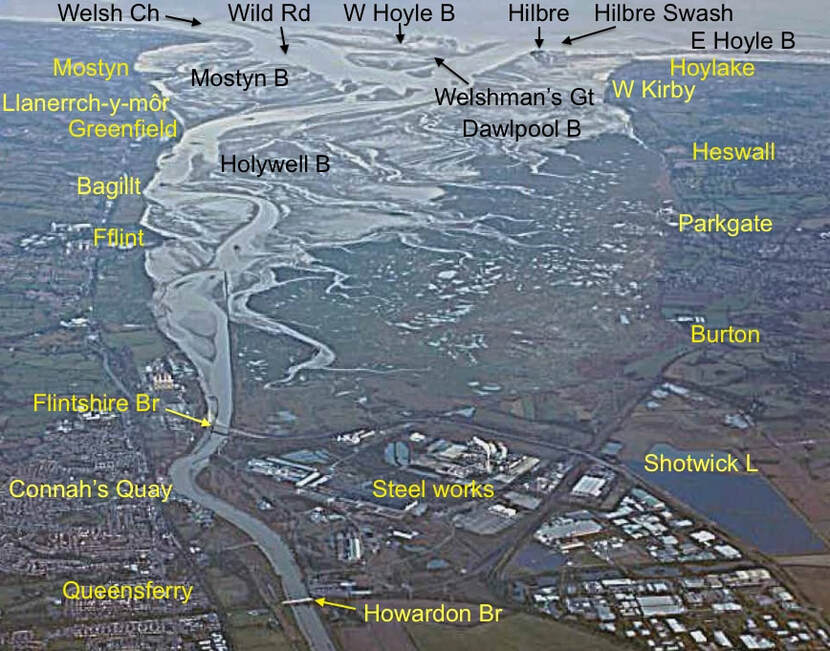
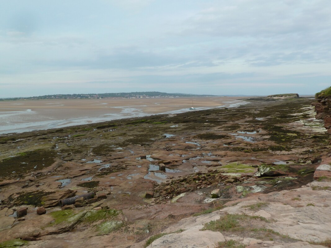
The Dee estuary, some five miles wide at its mouth and more than twice as long, divides the Wirral peninsula of north west England from the coast of north Wales. The estuary dries extensively and drains to the sea by two deep channels: westward by the Wild Road and the Welsh Channel around the Point of Ayr, and northward by the Hilbre Swash off the Wirral shore. Between these lies the West Hoyle Bank, the highest patch of which lies west of the HE4 (green) Hilbre Swash buoy. Here, the bank starts to dry at HW+3.5h, and a colony of grey seals hauls out to bask on the sand.
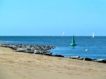
Seals hauled out on the West Hoyle Bank by the HE4 Hilbre Swash buoy
|
The Dee estuary - shading roughly represents LWN.
(Click to open pdf version for printing)
|
|
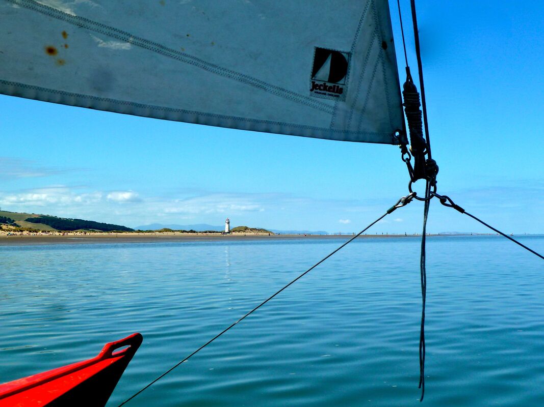
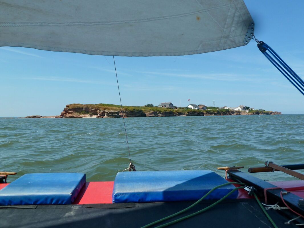
Hilbre is a tidal island situated at the extremity of a sandstone outcrop that protrudes north-westward from the Wirral shore. It is connected to its smaller neighbours Middle Eye and Little Eye by drying reefs. The islands are cut off from the shore within about HW+/-2h. From the high patch west of HE4, the West Hoyle Bank slopes away northward and can be crossed within HW+/-3.5h north of a line between the Hilbre Swash buoy HE2 (green) and the Point of Ayr lighthouse at the northern extremity of mainland Wales (white tower, disused). The only hazard to avoid in this vicinity (apart from the drying banks) is the wreck of the Nestos (see below), which is awash at half tide. |
Hilbre at LW viewed from Middle Eye
|
The mouth of the Dee estuary viewed from Hilbre to the Point of Ayr, across the Hilbre Swash and drying fingers of the W Hoyle Bank
|
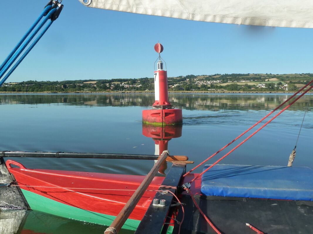
Hilbre Swash buoys HE2 and HE3 (green) mark the eastern extremity of a spit protruding from the West Hoyle Bank, around which the Hilbre Swash turns a dog-leg. The tide runs within the Swash around the end of the spit and joins the main tidal stream running E-W along the coast north of HE2. Boats sailing from the NE into the estuary against the ebb therefore should hug the East Hoyle Bank along the Wirral shore as close as depth allows in order to avoid the foul tide, and the same for sailing towards the NE out of the estuary against the flood. |
|
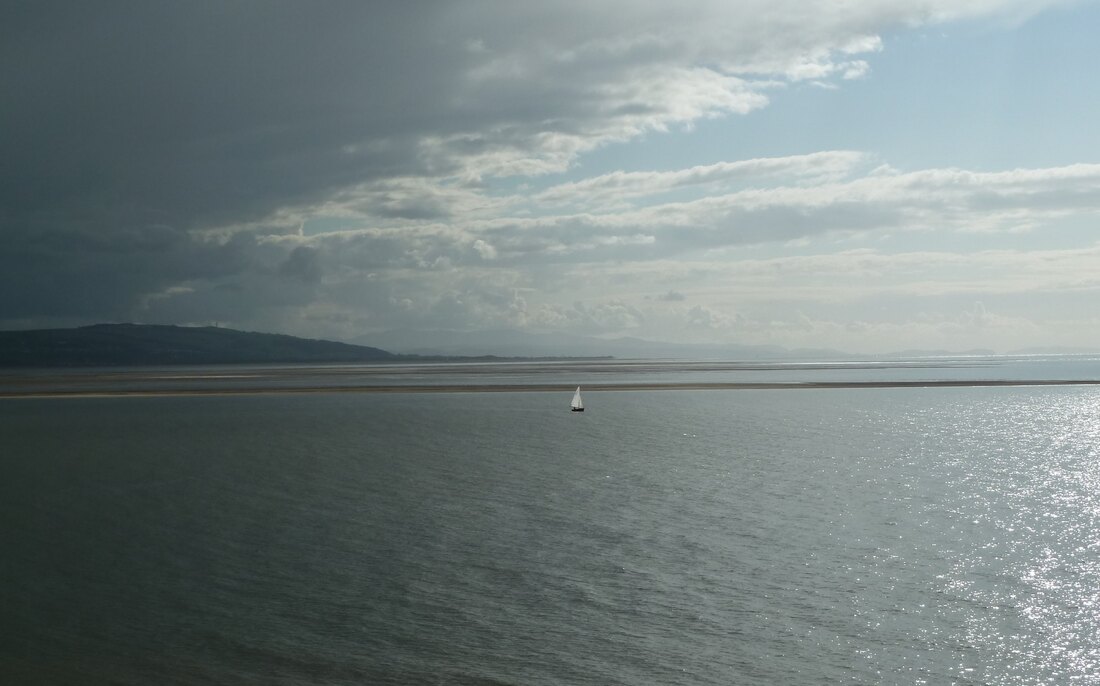
The wreck of the Nestos lies on the spit of the West Hoyle Bank due west of HE2. The Nestos was a freighter that grounded in fog during World War II having become separated from her convoy from Newfoundland bound for Liverpool. Boilers and other metal work are exposed at LW and are awash at half tide. Depth around the wreck is about 4 ft at mean LW. The transit HE2 to the Point of Ayr lighthouse clears the Nestos to the south. |
The wreck of the Nestos, with Hilbre and the Welsh shore in the distance
|
Off the Welsh shore the tide runs swiftly in and out of the Welsh Channel and the Wild Road, and can create lively conditions against wind. The ebb here runs for ~7h. For boats making passage eastwards up the Welsh coast towards the Dee, an offshore breeze at Rhyl will be deflected by the Clwydian Hills such that it comes right on the nose off Prestatyn; under such conditions it is rarely worth trying to beat against the ebb, but rather wait until the tide turns.
The Welshman's Gut crosses the estuary south of the West Hoyle Bank between the HE4 Hilbre Swash buoy and the Dee (S cardinal) buoy in the Welsh Channel and was formerly navigable at LW. Now, it dries after HW+4h. In very settled conditions, the entrance to the Gut west of HE4 makes a delightful overnight anchorage, with shelter afforded by the bank (and you are guaranteed to be visited by seals!)
The Welshman's Gut crosses the estuary south of the West Hoyle Bank between the HE4 Hilbre Swash buoy and the Dee (S cardinal) buoy in the Welsh Channel and was formerly navigable at LW. Now, it dries after HW+4h. In very settled conditions, the entrance to the Gut west of HE4 makes a delightful overnight anchorage, with shelter afforded by the bank (and you are guaranteed to be visited by seals!)
At anchor in the Welshman's Gut on the edge of the W Hoyle Bank
From HE4 a broad channel extends to the south, crossing the estuary diagonally in the direction of Fflint. South of Salisbury Middle it joins with the deep water of Mostyn Deep, the Wild Road and the Welsh Channel. The RIBs of cockle gatherers can often be seen dried out on the cockle beds of Salisbury Middle. Fflint is where tall blocks of flats are visible from a distance, hunched at the foot of the hills on the Welsh shore.
The channel towards Fflint is buoyed for barges that freight Airbus wings down the Dee at HW from Broughton (above Queensferry) to Mostyn for trans-shipment. The buoys are: 1 & 1a (fairway, red/white), 2 (red), 3 & 4 (green) and thence consecutively, close along the Welsh shore between Greenfield and Fflint, 5-8 (red/white). The shallowest depth is in the vicinity of buoy 3 (green), where passage at LWN is just possible, but not at LWS. Farther up, the limit of navigation at LW lies somewhere near Fflint. Sailing farther up with the flood into the canalized stretch of the Dee towards Chester is limited by the need to lower the mast at bridges.
The channel towards Fflint is buoyed for barges that freight Airbus wings down the Dee at HW from Broughton (above Queensferry) to Mostyn for trans-shipment. The buoys are: 1 & 1a (fairway, red/white), 2 (red), 3 & 4 (green) and thence consecutively, close along the Welsh shore between Greenfield and Fflint, 5-8 (red/white). The shallowest depth is in the vicinity of buoy 3 (green), where passage at LWN is just possible, but not at LWS. Farther up, the limit of navigation at LW lies somewhere near Fflint. Sailing farther up with the flood into the canalized stretch of the Dee towards Chester is limited by the need to lower the mast at bridges.
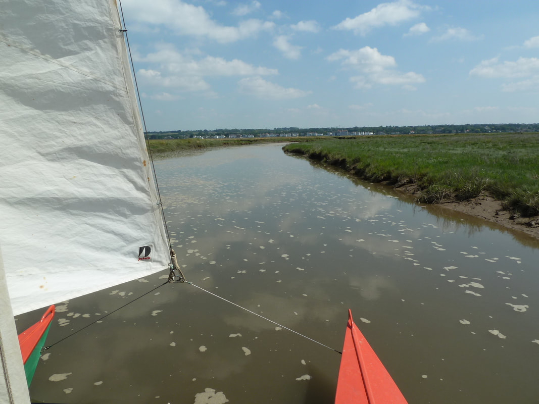
An extensive drainage from the marshes of the upper estuary, from around Parkgate and Neston, joins the main Dee channel opposite the village of Bagillt. This is navigable towards HWS (best with the flood) well up into the saltings towards Parkgate. The mouth of the drainage opposite Bagillt is sheltered from the NW by a significant sandbank that could provide shelter for possible anchorage. To enter the drainage, turn out of the main Dee channel when opposite the pylons that appear in a saddle of the hills on the skyline above Bagillt.
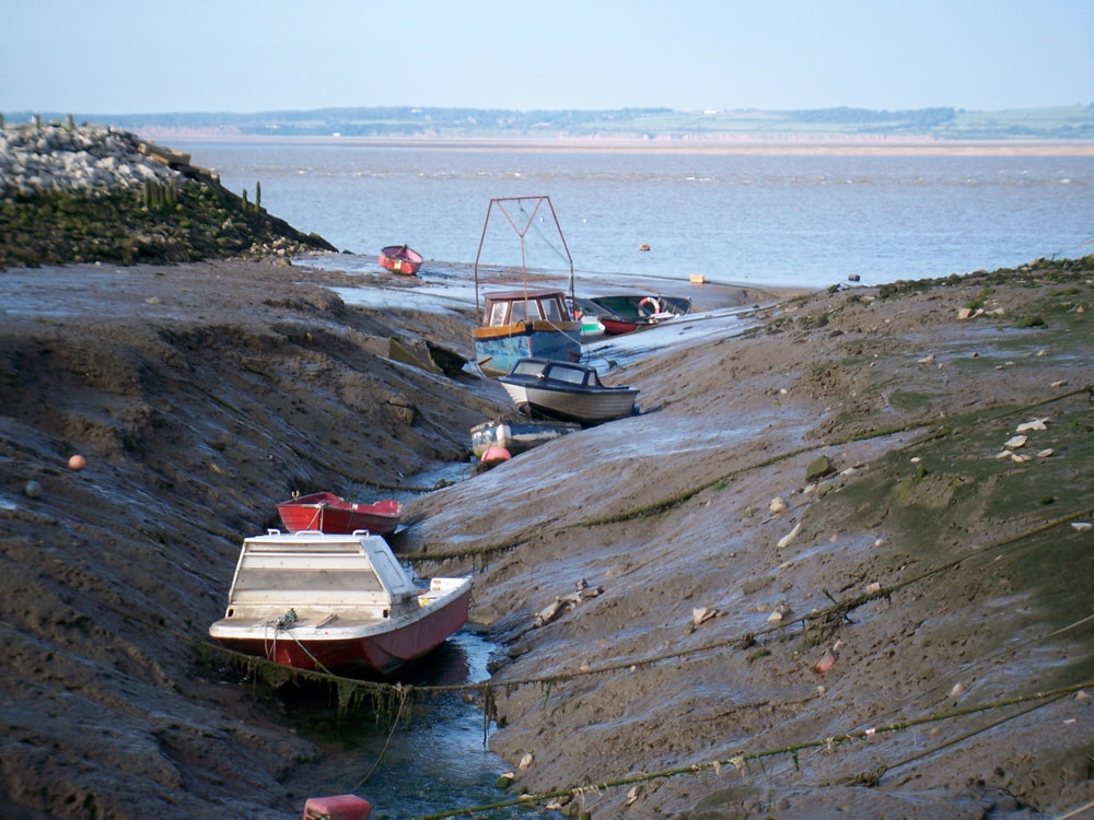
Much of the Welsh shore of the estuary is rather inhospitable, being an artificial seawall composed of boulders and rubble dropping steeply into the main channel. A narrow, steep-sided gutter runs down into the main channel at Greenfield, where a few boats are drawn up and fishing boats lie moored; and similarly a few boats are drawn up in a small creek near Bagillt.
During the first half of the ebb, before the banks start to dry, a northwesterly breeze can turn the channel into a wild roller-coaster ride with steep waves. Shelter can be had within HW+/-2.5h by dodging out of the channel into one of several small bays upstream beyond the end of, and inshore of the line of, the seawall between Greenfield and Bagillt. Here it is possible to drop anchor and dry out on a flat sandy beach backed pleasantly by a narrow strip of saltmarsh and coastal footpath. After HW+2.5h, the beach dries out beyond the line of the seawall and slopes steeply into the main channel, where there would be no shelter.
|
Farther down the Welsh shore at Llanerch-y-mor, the Irish ferry the Duke of Lancaster was driven ashore at HWS and concreted in, to be used for commercial purposes. The scheme failed and now she lies forlorn. The hull is painted white and makes a prominent landmark. Some decades ago it used to be possible to sail to the wharf here at HW. Notably, a crew from Hoylake SC used to sail a gaff cutter, under full sail and running a powerful inboard engine, across the estuary from Wirral, moor up for a pint in the pub, then return all on the same tide. The gutter however is now obstructed. |
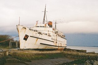
The Duke of Lancaster at Llanerch-y-mor
|
Yet farther down the estuary lies the commercial port of Mostyn, which amongst other things serves the local wind turbines and offshore gas rigs. Access to the quaysides at Mostyn is possible by small boat at LW by either of two buoyed channels from the Mostyn Deep, but there are no facilities for leisure craft.
Between Mostyn and the former colliery at Talacre near the estuary mouth, anchorage overnight is possible dried out on the mud of Mostyn Bank, with shelter from the NW by the Point of Ayr and from the SE by the mole of Mostyn dock. Higher up is an attractive stretch of secluded sandy beach - secluded because the coastal railway cuts off access from the land.
Between Mostyn and the former colliery at Talacre near the estuary mouth, anchorage overnight is possible dried out on the mud of Mostyn Bank, with shelter from the NW by the Point of Ayr and from the SE by the mole of Mostyn dock. Higher up is an attractive stretch of secluded sandy beach - secluded because the coastal railway cuts off access from the land.
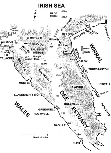
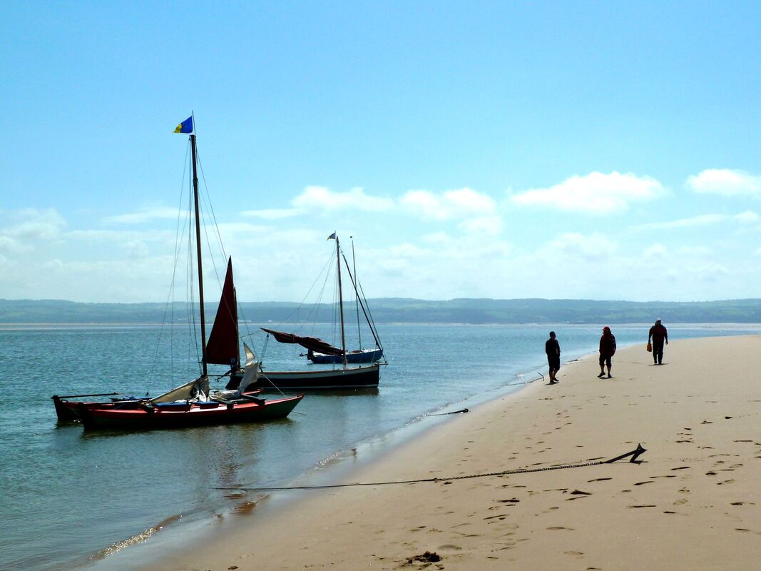
Back on the Wirral shore of the estuary, Hilbre is simply the nicest anchorage in the whole of Liverpool Bay. Anchor in sand and mud in the gutter that runs close along the NE side of the island. The anchorage is sheltered from W through S to E, but exposed to the N. However, even in a northerly breeze, as long as a boat lies well in the gutter and not exposed on the adjacent sandbank, any seas coming in have largely dissipated by the time they have run up the gutter, so being pounded on the ground by surf usually can be avoided. Aim to anchor close enough in to lie on sand & mud in the bed of the gutter, but not so close in as to lie on the rocks of the island foreshore. The rocks are mainly flat and smooth but provide no anchor holding. The bed of the gutter lies about 1/2 ca out from the HW line at the top of the foreshore. Probe the ground carefully with a pole or oar before grounding to be sure of settling on soft ground, and watch as the gutter starts to dry to be sure you're in line with it and not too far out. A small permanent mooring buoy, laid off the three cottages at the SE end of the island, in transit with the summit of Middle Eye gives the line of the bed of the gutter. Boats are afloat in the gutter within HW+/-3.5h
Hilbre can be circumnavigated in a boat of 1 ft draught, passing across the reef between Hilbre and Middle Eye, equidistant between the two islands, at HWS (minimum height 9.0m Liverpool).
The beach dries extensively off West Kirby and the limit of LW navigation on this side of the estuary is about 1 NM off the shore. Rocky reefs lie SW of Little Eye and in the vicinity of the Tanskey Rocks (out from West Kirby marine lake), these should be given a good offing except at HWS.
Yacht moorings are laid on the Wirral shore on mud flats off West Kirby SC near the southern end of the marine lake, off the Dee SC at Thurstaston, and in the saltings at the foot of Banks Road, Heswall. The higher up the estuary, the more sheltered the moorings. The WKSC and DSC moorings are accessible within about HW+/-2h, but access to the Heswall moorings is more limited.
Sheldrakes restaurant at Heswall used to be a fine place to sit and gaze out over the saltings with a beer, and it used to be an interesting expedition to carry the flood up, hugging the Wirral shore, all the way under sail, to stop for a beer, then carry the ebb all the way back down. Sheldrakes was once the former clubhouse of the Dee SC before the latter moved to its present premises on the clifftop at Thurstaston. Sadly, though, it has now closed. Furthermore, at time of writing [Jan 2023], the neighbouring boatyard is due to close too, so now there is little incentive to visit what used to be an active boating centre, for now it is little more than a graveyard for derelict boats.
The moorings on the Wirral shore are partly sheltered by outlying sandbanks. To reach the moorings from the mouth of the estuary by the deepest water, sail as follows. From entering the estuary by the Hilbre Swash round the northern tip of Hilbre, sail a course towards Fflint, visible 10 NM distant where prominent tower blocks stand near the shore at the foot of the hills on the Welsh shore (bearing about 160°). This course keeps you in the deep water of the Swash, well out from the shoals and the Tanskey Rocks off West Kirby. Hold the course for about 2 NM, making sure to leave any shoal water to port, until within 1 ca of the Dee No.1 (fairway) buoy. Here, in transit between the Pt of Ayr Lighthouse (at the mouth of the estuary on the Welsh shore) and the Dee SC (situated on the clifftop at the N end of a prominent band of sand-coloured cliff on the Thurstaston shore), bear to port (bearing ~90°) and sail directly towards the Wirral shore. Head towards a point on the shore about midway between the Dee SC and the last of the houses of Caldy on the clifftop south of West Kirby. Hold this course for a while until the West Kirby SC moorings can be laid on a course due N, then either turn to port to head directly for these, or continue on the heading of 90° towards the shore if bound for the Dee SC or Heswall. When the West Kirby SC moorings and the Dee SC moorings come into transit (within about 2 ca of the shore) turn to starboard towards the Dee SC moorings. Do not cut the corner as shoals of cockle beds lie close to starboard. The turn is marked by dark green(-ish) painted jerry cans - leave these to starboard.
Follow the gutter up to the Dee SC moorings keeping 1-2 ca offshore (buoyed by red or green jerry cans.) The Dee SC comes into view on the clifftop. Keep offshore at least 1 ca to avoid a drying causeway extending out from below the clubhouse - head initially towards the outer moored boats until south of the clubhouse and clear of the causeway. The gutter then continues parallel to the shore a further 2 NM all the way to Heswall. Once within the saltings at Heswall the course of the gutter is marked by posts. If planning to anchor and dry out at Heswall, check the ground carefully because the gutter has steep-sided mud banks, and debris from derelict boats and moorings is strewn about.
Good anchorage on flat mud can be had anywhere between the Dee SC and Heswall. The mud is firm to walk on (but carry a pole to probe any dubious looking pools.) Wellies are useful for walking ashore.
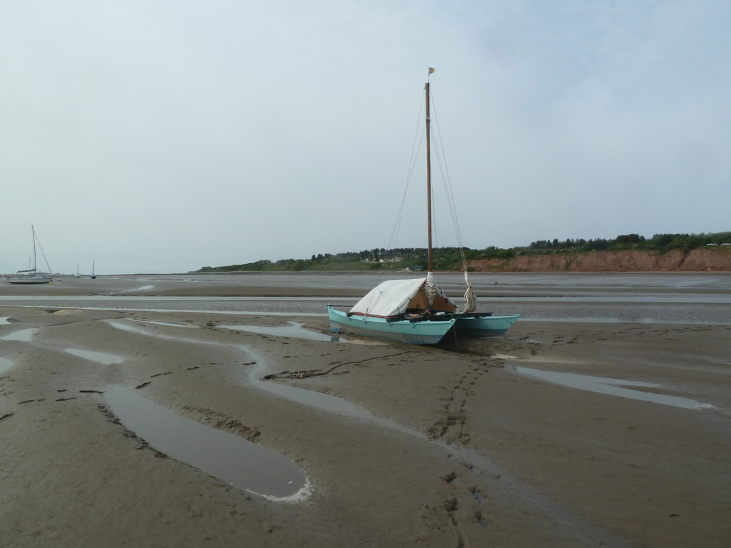
At anchor off the Dee SC. The clubhouse can be seen above the white boat tent, to the left of the sand-coloured band of cliffs.
Launching - generally only possible within HW+/-2h
Wirral shore
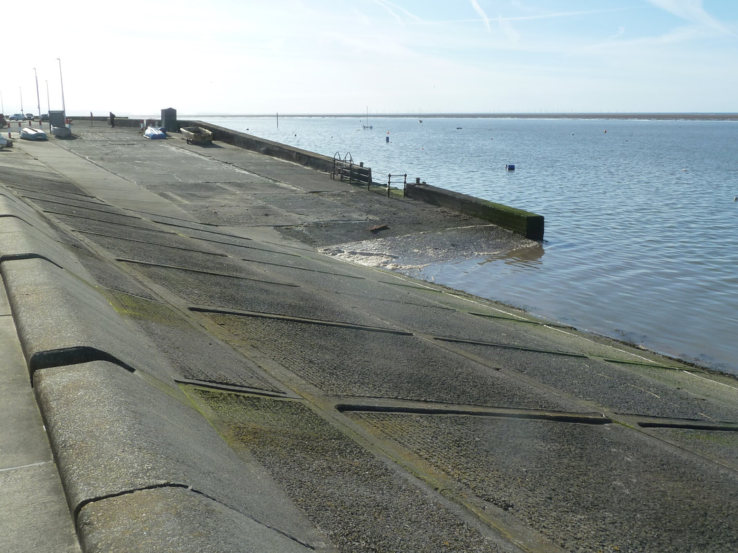
1. Dove Point slipway, Meols, at the eastern end of Meols-Hoylake promenade, north Wirral.
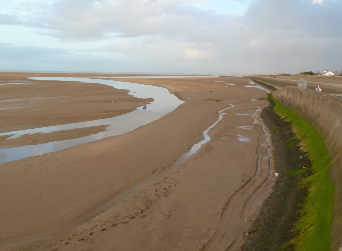
Broad concrete slipway suitable for big heavy boats, with ample free parking at the top. Gives access to a mooring area sheltered from the open sea by the East Hoyle Bank. The moorings are drained by a gutter running ENE close alongside the seawall for 1 NM, until beyond Leasowe Lighthouse (conspicuous white tower, disused, 1/2 way along the north Wirral shore) from where the gutter drains obliquely out to sea over sand flats. Sailing to the Dee estuary from here involves an offshore passage westward round outside the East Hoyle Bank.
1. Dove Point slipway, Meols, at the eastern end of Meols-Hoylake promenade, north Wirral.
Broad concrete slipway suitable for big heavy boats, with ample free parking at the top. Gives access to a mooring area sheltered from the open sea by the East Hoyle Bank. The moorings are drained by a gutter running ENE close alongside the seawall for 1 NM, until beyond Leasowe Lighthouse (conspicuous white tower, disused, 1/2 way along the north Wirral shore) from where the gutter drains obliquely out to sea over sand flats. Sailing to the Dee estuary from here involves an offshore passage westward round outside the East Hoyle Bank.
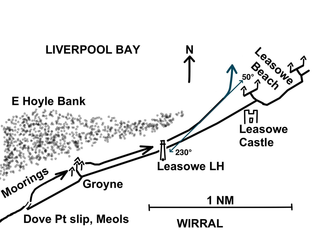
Course to follow for deepest water from Dove Point slipway to the open sea, within HW+/-2h. Minimum height of tide to float at the slipway (with 1 ft draught) is ~7.0 m (Liverpool). With 9.2 m height of tide, boats can sail due N directly across the outer bank from the slipway.
2. West Kirby, south end of the marine lake next to West Kirby SC.
Broad concrete slipway suitable for big heavy boats, launching onto a flat expanse of mud where WKSC boats are moored. Parking is severely restricted near the slipway.
3. Dee SC, Station Rd, Thurstaston.
Very steep narrow lane down onto the beach for beach-launching. Not suitable for heavy boats unless assisted by the club tractor.
4. Heswall, Banks Road.
Good concrete slipway into a narrow, steep-sided mud gutter. Pay-carpark nearby, but no overnight parking. Neighbouring boatyard believed closed or due to close shortly. Access to open water by rather tortuous mud gutter at HWS.
Sailing outside the E Hoyle Bank off the north Wirral shore. Leasowe lighthouse is prominent on the shore.
Welsh shore
1. Connah's Quay (upstream of Fflint and the cable-stayed Flintshire Bridge.)
I'm told there is a slipway here but I have never investigated.
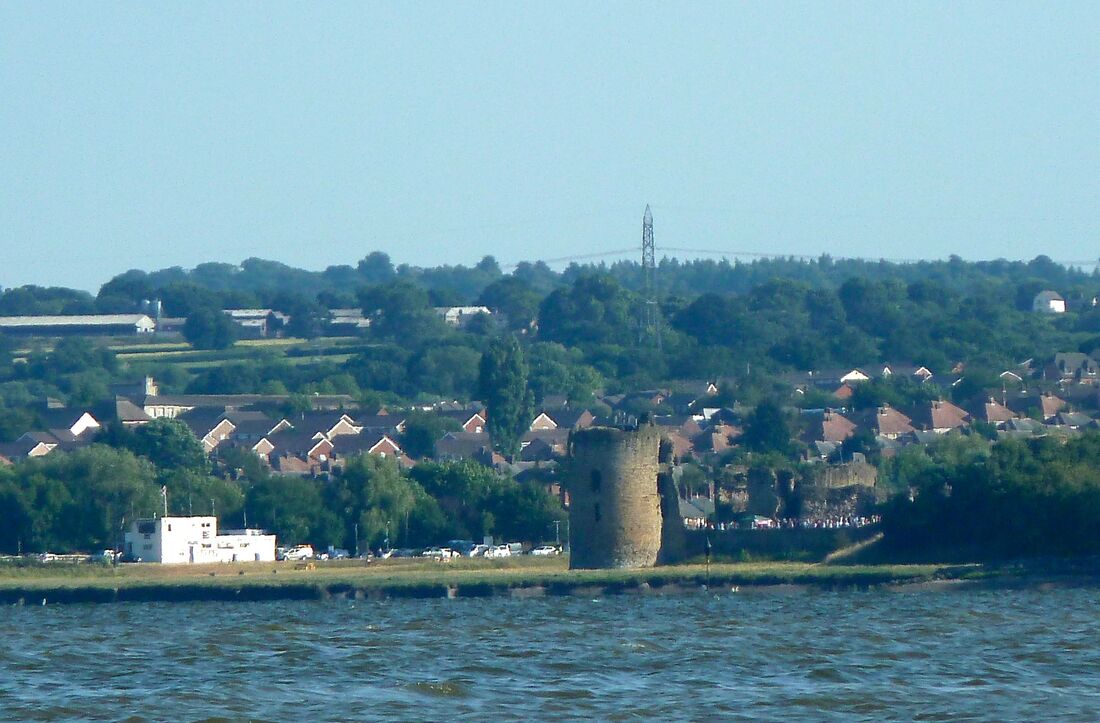
2. Fflint
The slipway at the end of the lane alongside the narrow cut near the castle is now barred by a padlocked gate. Perhaps enquires about access could be made at the RNLI inshore lifeboat station.
3. Greenfield Dock
A narrow, rather steep slipway runs down towards the main channel close south of the steep-sided gutter where small boats are moored. Only suitable for light dinghies, not suitable for vehicles. Notably, this is where DCA member John Gray launched his Mirror dinghy "Little Mischief" to embark on his epic cruise around the coast of Wales to Cardigan Bay and back in 1983, the written account of which, "Cruising on the Dole", is probably my favourite DCA cruise account of all time! [In three parts: DCA Bulletin 101 pp10-17, 102 pp20-25 & 103 pp18-23]
4. Prestatyn Sailing Club, at the eastern end of Prestatyn promenade, north Wales coast.
If the gate to the public slipway is locked, then Prestatyn SC offers temporary membership to use its own slipway, a short concrete slipway on to the top of the beach, giving access into the Welsh Channel. Prestatyn SC has a tractor to launch over the beach at lower states of the tide. Although it is called a 'sailing club', Prestatyn SC is actually a motor fishing boat club! I found the members friendly and helpful when once I had to land there with rigging failure.
1. Connah's Quay (upstream of Fflint and the cable-stayed Flintshire Bridge.)
I'm told there is a slipway here but I have never investigated.
2. Fflint
The slipway at the end of the lane alongside the narrow cut near the castle is now barred by a padlocked gate. Perhaps enquires about access could be made at the RNLI inshore lifeboat station.
3. Greenfield Dock
A narrow, rather steep slipway runs down towards the main channel close south of the steep-sided gutter where small boats are moored. Only suitable for light dinghies, not suitable for vehicles. Notably, this is where DCA member John Gray launched his Mirror dinghy "Little Mischief" to embark on his epic cruise around the coast of Wales to Cardigan Bay and back in 1983, the written account of which, "Cruising on the Dole", is probably my favourite DCA cruise account of all time! [In three parts: DCA Bulletin 101 pp10-17, 102 pp20-25 & 103 pp18-23]
4. Prestatyn Sailing Club, at the eastern end of Prestatyn promenade, north Wales coast.
If the gate to the public slipway is locked, then Prestatyn SC offers temporary membership to use its own slipway, a short concrete slipway on to the top of the beach, giving access into the Welsh Channel. Prestatyn SC has a tractor to launch over the beach at lower states of the tide. Although it is called a 'sailing club', Prestatyn SC is actually a motor fishing boat club! I found the members friendly and helpful when once I had to land there with rigging failure.
Useful Links
Chris Michael's guide to Boat Cruising on the Dee Estuary.
Dee Conservancy guide to Safe navigation in the Dee estuary.
Contact details for the Dee Conservancy Harbour Master:
email: [email protected] or phone: 01244 371428 or 07894 790378
Dee Conservancy guide to Safe navigation in the Dee estuary.
Contact details for the Dee Conservancy Harbour Master:
email: [email protected] or phone: 01244 371428 or 07894 790378
The friendly club with a sense of adventure. For all sailors who use boats for more than just racing.
|
© 2010-2024 DCA. All Rights Reserved. |
|